
- Home
- Brands

- Clothing
- Footwear
- Equipment
- Accessories
- Binoculars
- Bivy Bags and Hammocks
- Brew
- Chargers
- Cookwear
- Food
- Furniture
- Hydration Storage/Bladders
- Knives And Multi Tools
- Lighting
- Maps n Books
- Navigation
- Personal Locator Beacons
- Repair Kits / Sealers/Waterproofs
- Solar Equipment
- Sleeping Accessories
- Sleeping Bags
- Sleeping Mats
- Stoves
- Storage/Dry Sacks
- Survival / First Aid
- Tarps
- Tents
- Trekking Poles
- Water Treatment
- Waterproofing / Sealing Agents
- Packs
- Climbing Gear
- Paddle
- Vouchers
- Clearance

Buller Vicmap 1-50,000
$11.99
Related products
-
Sale!
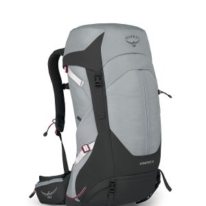
Osprey Stratos 36LT NEW
Original price was: $329.99.$299.99Current price is: $299.99. Select options This product has multiple variants. The options may be chosen on the product page -
Sale!
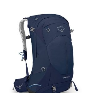
Osprey Stratos 34Lt NEW
Original price was: $309.99.$289.99Current price is: $289.99. Select options This product has multiple variants. The options may be chosen on the product page -

Sport Wash 532ml
$17.99 Add to cart -
Sale!
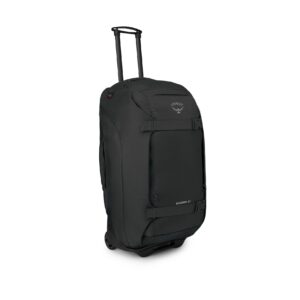
Osprey Sojourn 80lt/28inch Wheeled Travel Bag NEW 2023/2024
Original price was: $749.00.$679.00Current price is: $679.00. Select options This product has multiple variants. The options may be chosen on the product page